Introduction
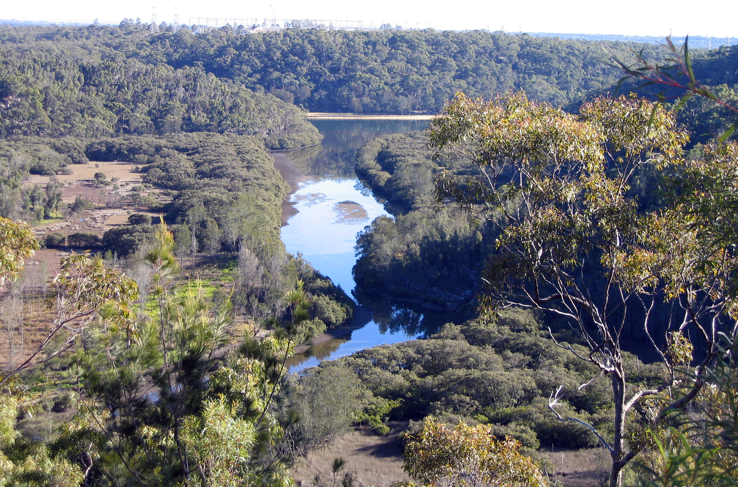
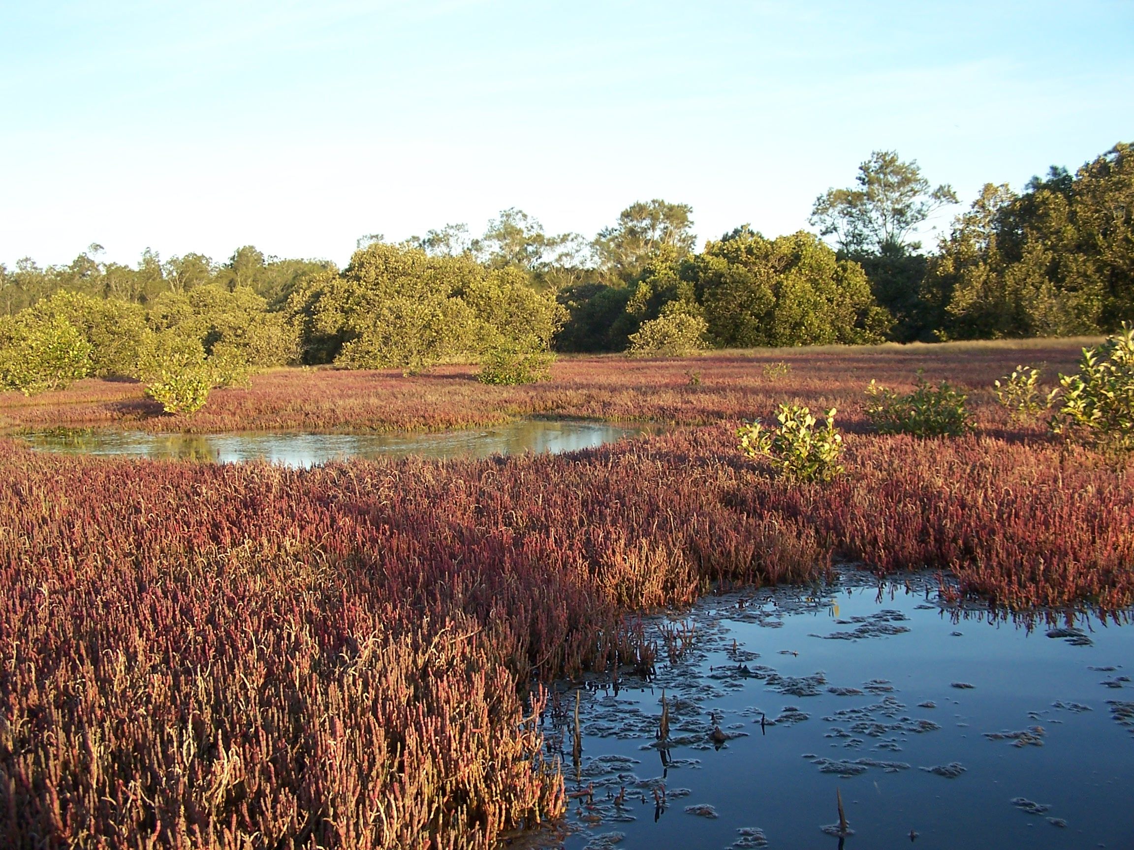
A salt marsh is an ecosystem that is integrally part of a bigger system, that of estuarine or intertidal wetlands. A salt marsh is an environment in the upper coastal intertidal zone between land and salty or brackish water, dominated by dense stands of halophytic (salt-tolerant) plants such as herbs, grasses, or low shrubs. These plants are terrestrial in origin and are essential to the stability of the salt marsh in trapping and binding sediments.
Important ecosystem
Salt marshes play a large role in the aquatic food web and the exporting of nutrients to coastal waters. They also provide support to terrestrial animals such as migrating birds as well as providing coastal protection.
Undervalued ecosystem
Salt marshes are particularly endangered within the estuaries found along the coast of NSW. They have been little understood and little valued in the past. Consequently they have been filled, often with garbage, reclaimed and therefore lost as functioning ecosystems, particularly within rapidly urbanizing contexts. They are now often invaded by mangroves colonizing landwards. For these reasons they are now listed in NSW under the Threatened Species Act as endangered ecological communities.
Location

Within NSW, the following areas are known to contain salt marsh:
-
all of the northern NSW coastal rivers
-
the Lane Cove River, Homebush Bay, Botany Bay and Georges River in the Sydney region
-
the Shoalhaven River, Currenbene Creek, Merimbula Lake, and Pambula Lake on the south coast.
Distribution
The distribution of salt marsh is within a vegetation zonation which depends on elevation and hydrology. Seagrasses are wholly inundated (flooded) by the estuarine waters in rivers and bays. Moving landwards within the intertidal zone; mangroves are followed by salt marsh, then freshwater rushes and reeds, casurina forest, then Eucalypts. Coastal riverflat forests occur commonly on land adjoining estuaries. The distribution of salt marsh is determined by the level of inundation by the tides and levels of water salinity.
Google Earth
An example of a salt marsh ecosystem lies in the area near the Kooragang Wetland Rehabilitation Project on Google Earth. To move out of street view level and look at the wider area click the yellow person icon in the bottom right hand corner. This resource will only work in the Google Chrome browser.
Significance

Plants
The salt marsh flora is considerably more diverse than mangrove flora in temperate southeast Australia (Adam, 1994*). Characteristic plants include:
-
Bare twig rush (Baumea juncea)
-
Salt marsh rush (Juncus krausii)
-
Beaded samphire (Sarcocornia quinqueflora)
-
Saltwater couch (Sporobolus virginicus)
-
Streaked arrowgrass (Triglochin striata)
-
Knobby club rush (Isolepis nodosa)
-
Creeping brookwood (Samolus repens)
-
Swamp weed (Selliera radicans)
-
Seablite (Suaeda australis)
-
Prickly couch (Zoysia macrantha).
Occasionally mangroves are scattered through the salt marsh. Tall reeds may also occur, as well as salt pans.
Animals
Salt marshes are the spawning grounds of crabs, with this spawning triggered during spring maximum tides. Crab larvae are an important food source for fish in estuaries. Nineteen species of estuarine fish use salt marsh habitat and the larvae of rare butterflies, including the Salt Pan Blue (Theclinesthes sulpitius) and Painted Skipper (Hesperilla picta) butterflies depend on it. Salt marshes are part of an estuarine buffer zone that filters run-off and soaks up flood peaks.
*Adam, P. (1994) Saltmarsh and Mangrove. Cambridge University Press, Cambridge pp. 395-436
Conservation

In 1982 the south east Australian bioregions contained only 354 square kilometres of salt marsh, yet it was recognised as the most biodiverse type of salt marsh in Australia, with the greatest species richness and incidence of species endemic to Australia. It can be invaded by mangroves at its wet edge, and by other wetland species and human encroachment at its dry edge, and is thus being squeezed out. In the Sydney region the decline of the swamp wallaby has been suggested as a contributing factor as they were known to limit the landward encroachment of mangrove seedlings by grazing on them.
Threats to salt marsh
Major threats are:
-
infilling for development for example roads, residential, waste disposal, agriculture, industrial and recreational uses
-
modification of tidal flows as a consequence of artificial structures being erected
-
alteration of salinity and increasing nutrient levels resulting from the discharge of stormwater into salt marshes, which favours wetland species (other than salt marsh) that like the ‘freshwater’ input (such as Phragmites)
-
weed invasion especially by Spiny rush (Juncus acutus)
-
physical damage from human disturbance, such as trail bikes, domestic and feral animals
-
invasion by mangroves
-
inappropriate fire regimes
-
dumping of rubbish and pollution from oil or chemical spills from shipping or road accidents, catchment runoff of nutrients and agricultural chemicals.
Environmental Education Centres

The Georges River EEC is located on the Georges River, at the heart of one of the most urbanized river catchments in Australia. Despite this more than 40% of the land area of the catchment remains natural, and much of that is in protected reserves.
Excursions
Our excursions and fieldtrips are organised quite flexibly to take advantage of both these more pristine areas and smaller remnants of swamp, bushland, freshwater and saltwater environments. We focus on river quality monitoring, bushcare and sustainable resource management and practise to foster an ethic of care and citizenship in schools and students who participate in our programs.
Further Environmental Education Centres
Coastal and estuarine Environmental Education Centres are able to assist schools with programs based on intertidal wetlands, including:
-
Wetlands (Hunter/Central Coast)
-
Rumbalara (Hunter/Central Coast)
-
Field of Mars (Northern Sydney)
-
Illawarra (South Coast)
Further information
Useful links
-
Wikipedia - Saltmarsh
-
NSW Department of Primary Industries – Estuarine habitats
-
Australian Online Coastal information - Saltmarsh and saltflat areas
-
CSIRO Publishing - Trophic relationships between fish and crab larvae in a temperate Australian saltmarsh
-
Waterwatch NSW Resources – Waterwatch manuals
Further reading
N. Santilan and R. Williams; Shortnote: ‘The decline of saltmarsh in south-east Australia; Australia; Results of recent surveys’, Sydney Olympic Park, 16 March 2007.