Introduction
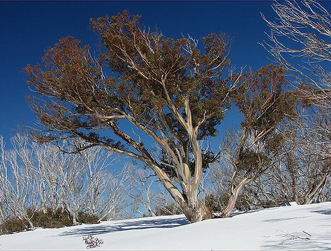
Alpine refers to land above the tree line. This occurs at approximately 1,850 metres above sea level in the Snowy Mountains.
Climate
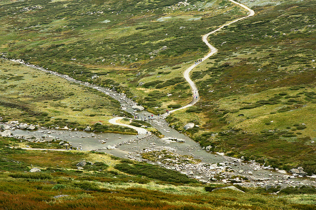
Alpine ecosystems have cool to cold temperatures, very high rainfall and winter snow cover. Even though alpine areas have the same general climate, different plant communities grow in different micro-climates provided by the landscape.
Plants
The major plant community is the tall alpine herbfield which covers approximately 60% of the area and grows on gentle slopes. Other communities include:
-
short alpine herbfield communities found below melting summer snow patches
-
windswept feldmark communities found on exposed ridges where there is a stony pavement
-
bog communities found in areas of poor drainage and shrub communities near the warmth of boulders.
Animals
Mammal, amphibian and reptile species are scarce compared to lower altitudes. Large herbivores appear unable to obtain sufficient food in winter from beneath the snow.
Location
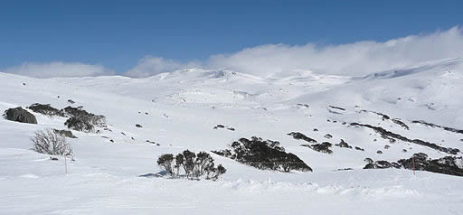
Alpine ecosystems do not have trees because they cannot survive once the average temperature of the warmest month is below 10°C.
Alpine in Australia
Australia has 770 km2 or 0.01% of its land area covered by alpine ecosystems. They are located in Tasmania, and in the Australian Alps, part of the Great Dividing Range near the New South Wales and Victorian borders.
Kosciusko National Park
The alpine area of the Snowy Mountains within Kosciusko National Park is 160 km2 in area. Uplift of the plateau has caused the climate to be very severe causing great natural stress. The temperature normally decreases by about 6.5°C per thousand metre increase in altitude.
Snow Cover
The alpine area has a continuous snow cover for at least 4 months of the year (June–September). On average there are only 10 frost free days per year on Mt. Kosciuszko which also has up to 3 000 mm of precipitation each year and wind velocities of 150 k.p.h.
Google Earth
An example of an Alpine ecosystem lies in the area around Mount Kosciusko National Park on Google Earth. To move out of street view level and look at the wider area click the yellow person icon in the bottom right hand corner. This resource will only work in the Google Chrome browser.
Significance
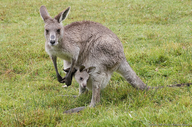
Food chains show the flow of energy from plant to herbivore to carnivore. The more energy from the sun converted into chemical energy by photosynthesis in plants, the more animals that can be supported in food chains.
Limited biomass
In the Kosciuszko area, plants grow for only four months of the year because of the low temperatures; hence plant biomass is very low. This is the weight of plant material or the amount of food available to support the food chain. Rainforests (world average) have a plant biomass of 45 kg/m2 and can support a lot of herbivores but the world average for alpine areas is only 0.6 kg/m2 so there is not much food for herbivores and even less for carnivores.
Value of alpine areas
Alpine areas are valued because:
-
Utility: they have been used for gold mining, cattle grazing, as a water catchment for the Snowy Mountains Scheme and the present day ski resorts.
-
Cultural heritage: includes evidence of the cattle grazing era with the many huts which were used by cattlemen during summer grazing of the high country.
-
Natural heritage: the alpine area includes our highest mountain, evidence of the last glaciation with the glacial land forms of lakes, cirques and moraines and the alpine plants and animals.
-
Intrinsic: the alpine area is valued for its natural beauty.
Indigenous culture
Aboriginal people did not live permanently in the high country, but migrated there seasonally. The migration of Bogong moths to the cool mountains in summer represented a seasonal concentration of a food resource which Aboriginal people used. The Djilamatang from the western plains would gather near Tumut, the Ngario from the tablelands to the east would gather near Jindabyne and the Jaitmajhang travelled from Victoria.
Conservation

Historical damage
Grazing of the alpine area by cattle and sheep started in the 1830’s and was eventually prohibited above 1370 metres in 1958 due to severe soil erosion. The low vegetation biomass meant there was little food for herbivores and once eaten, the plants took a long time to grow back because of the short growing season due to the cold. This left the soil unprotected from wind, water and ice, the agents of erosion. The high country was being used in an unsustainable way.
Becoming a national park
The most significant development in sustainable management occurred when the area was declared a national park in 1967. The area was then covered by government legislation to protect it, but also to allow suitable use by people.
Balancing act
To protect but also allow sustainable use caused a dilemma for the managers of Kosciuszko National Park. There are many possible land uses but which ones were compatible with the sustainable use of the environment? Not all alpine and sub-alpine areas are the same. The Kosciuszko area is the highest and most fragile and also the area most in demand by tourists. Some areas have very little access, towards the centre of the Park and surrounded by very rugged terrain, other areas are near the edge of the Park and have good access and snow cover in winter.
Environmental education centre
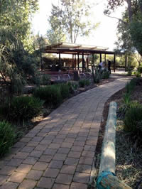
The Riverina Environmental Education Centre (EEC) provides a limited number of two-day field study programs for Year 12 Geography students in Terms 1 and 4.
Groups are met at Thredbo and study the natural ecosystem on the walk to Kosciuszko.
Management issues are studied on the second day in the Perisher Valley area.
Field study worksheets, risk assessments and lessons can be viewed on the Riverina EEC’s website.
Further information
-
NSW Government, Office of Environment and Heritage - Australian Alps – biodiversity
-
Australian Alps National Parks — Bimberi Nature Reserve
-
Australian Alps National Parks – Nature and biodiversity
-
Wikipedia – Feldmark
-
Australian National Botanic Gardens - Alpine shrubland and herbfields
-
ABC Landline – Alpine catchments
-
Backyard Buddies – Bogong Moths